College Street, Virginia Avenue, Barnesville Highway, Kings Highway, Farmville Highway, Farmville Road, Prince Edward Highway, Sheppards Road, James Madison Highway, Oak Street, Main Street, Martinsburg Avenue, Caroline Street, South Madison Road, North Madison Road, Eastern Bypass, Lee Highway, James Monroe Highway, South King Street, Leesburg Bypass
- Direction:
- North/South
- Southern Terminus:
- North Carolina-Virginia state line
- Northern Terminus:
- Virginia-Maryland state line
- Distance:
- 230.76 miles
- Counties:
- Mecklenburg, Charlotte, Prince Edward, Buckingham, Fluvanna, Louisa, Orange, Madison, Culpeper, Fauquier, Prince William, Loudoun
- Signed:
- Yes
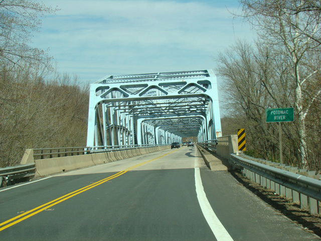
US 15 is a north/south route extending from Walterboro, South Carolina, to Painted Post, New York. The section in Virginia runs down the center of the state, staying west of the major cities such as Richmond and Washington. In most areas, it is known as James Madison Highway in honor of our country's fourth president, although near the northern end it is known as James Monroe Highway in honor of our country's fifth president. It is multiplexed with a number of other routes along the way, including US 360, US 460, US 33, US 17, and VA 7. At the state line, the Point of Rocks Bridge carries US 15 across the Potomac River to Maryland.
| Photo Gallery |
|---|
| Map |