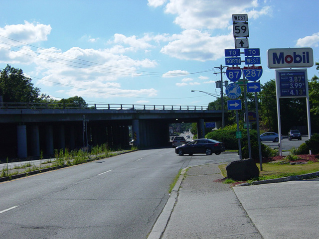
- Direction:
- East/West
- Western Terminus:
- Orange Turnpike (NY 17) in Suffern
- Eastern Terminus:
- South Highland Avenue (US 9W) and North Highland Avenue (US 9W) in Nyack
- Distance:
- 13.86 miles
- Counties:
- Rockland
- Signed:
- Yes
NY 59 is a major east/west route in Rockland County and the southernmost east/west state route on the west side of the Hudson River. It begins in Suffern near exit 15A of the New York Thruway (I-87) as Orange Turnpike, which is designated NY 17 north of this point. NY 59 follows Orange Turnpike to the south, crossing the Thruway just east of the point where it merges with I-287. Just south of the Thruway, it is multiplexed with US 202 for a block and then turns east onto Lafayette Avenue. It runs east, following Nyack Turnpike, Alturas Road, and East Central Avenue to US 9W in Nyack, where it ends. NY 59 is a two-lane road from Suffern to Spring Valley and four- to six-lane road from Spring Valley to Nyack. Some portions are divided and others are undivided.
| Photo Gallery |
|---|
| Map |